Cahokia is an archeological treasure in the midst of a modern landscape. It is the remnant of a thousand year old landscape, which has managed to survive to today. At its peak 800 years ago Cahokia was the largest city north of Mexico. Made of earth and wood, it rivaled contemporaneous London in size and commanded the middle Mississippi. When a city is built from dirt and wood, it doesn’t take long for weather to begin dulling its details. Then, when a new civilization with bulldozers moves in, history can be levelled. But the vestige of Cahokia remains, a complex of 80 earthen mounds on the bottomlands eight miles west of Saint Louis.
The Cahokia Mounds State Historic Site is under the protection of Illinois State Parks and supported by the Cahokia Mounds Museum Society. Turning off Collinsville Road is a modern parking area next to the dominant feature of the landscape, Monks’ Mound. It is a flat-topped pyramid standing 100-feet tall with a wide terrace at mid-level. Now concrete steps take the place of what would have been wooden steps to the top. It is the highest pre-Columbian construction in the United States.

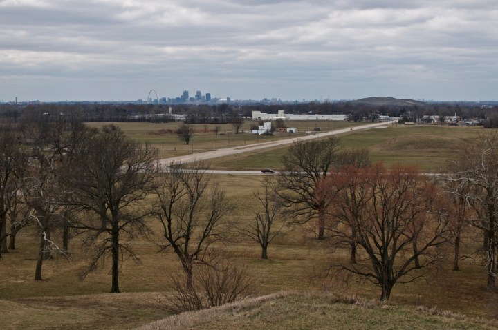
From the top you can see for miles in every direction across the Mississippi bottomlands. Looking east the road climbs the escarpment a couple of miles away into the town of Collinsville. This is the eastern wall of the Mississippi bottom. Northwest is Granite City, Illinois with its russet US Steel Plant anchored in the lowlands. Due west, rises the modern city of Saint Louis, Missouri, on the bluff on the far bank of the great river. Cahokia is the heart of the river bottom. The only other prominence in the lowland is modern civilization’s echo to Cahokian earthworks. Halfway to Saint Louis you can see the soil covered Milam Landfill, where the trash of a city is buried. Looking across one mound to the next is looking across layers of history and culture and landscape.
Cahokia is a layered story. The landscape is literally shaped by layers of earth built up over time. The mounds accreted layer by layer over hundreds of years. Older mound layers include evidence of structures that were later buried and built upon. Mounds served different purposes. Some were ceremonial, others were funeral. Still others were more functional serving as waste piles. Studies of the landscape indicate that the current flat terrain is not natural but was created during the mound-building era from uneven rolling land. Monk’s Mound was built up over centuries with at least ten distinct building phases. At its final summit stood a 5000 square-foot structure. Mound 72, one of the best studied, was originally built as several small mounds and later joined and reshaped. It contains the burial of a prominent male and 250 other individuals, over half of which seem to have been human sacrifices. Both from its size and construction as well as other evidence, the Middle Mississippian culture centered at Cahokia was highly structured with many layers in its hierarchy.
Layers of cultures that have shaped the landscape left evidence in subtle and not so subtle ways. While the hierarchical nature of the Mississippians persists in the form of the land, it takes a landscape archeologist to discover the organic post holes left by the wooden stockade surrounding the central court, or the circular array known as woodhenge, or the density of houses. By the time French explorers had arrived 300 years ago, the builders were gone. The French created a mission on top of the largest mound of the old city, giving it the name Monks’ Mound. Throughout the 18th century the region was frontier until French fur traders, Laclède and Chouteau, founded Saint Louis in 1764 on the western bluffs of the Mississippi. Early American culture began dominating the landscape after the Louisiana Purchase in 1803. Saint Louis became the gateway to the west and grew quickly as an inland port and then as an industrial center. Cahokia was the greatest concentration of mounds, but mounds existed all through the Mississippi Valley. The ones in Saint Louis were all levelled to make way for the growing city, except for one. Fortunately, the landscape around Cahokia was not directly in the path of industrial culture and was missed by the steam shovels.
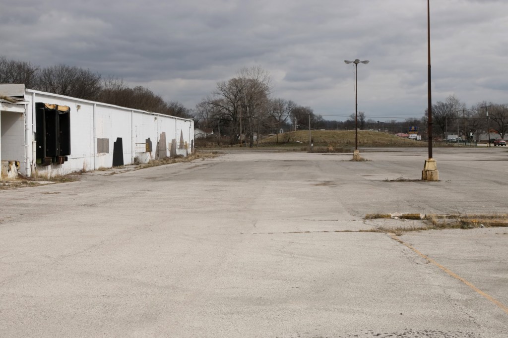
Still indignities encroached upon the site. The first indignity to Cahokia is also the road that brings you there. Collinsville Road cuts the historic site in half. Collinsville Road was the main track across the river bottom. Modern commerce built squat cinder block boxes along the road, on the toe of Monks’ Mound. They are now abandoned canvasses for graffiti. On the eastern part of the site, State Park Place, a residential subdivision of modest homes and trailers, was laid down around outlying mounds. There are 40 identified mounds not in the park. In State Park Place overgrown mounds are now fenced off from the neighbors with chain links. Gashes in the fence allow the local dogs access. Adding injury to insult, Interstate 70 runs along the northern end of the site. Although it diminishes Cahokia, perversely, construction of the highway precipitated research into the site by directing attention and resources to urgent preservation research.
The current cultural period at Cahokia is curatorial. The State of Illinois first authorized protecting the core of Cahokia as a state park in 1923. This is a fraction of the five square-miles the city covered at its peak. By the mid-1960s, Cahokia received federal designation as a National Historic Landmark. Then in 1982, it was listed as a World Heritage Site by UNESCO, the tenth in the United States. There are now 24 in the US.
Gazing south from the summit of Monk’s Mound is the most encouraging sight. Here lies the bulk of the Cahokia Mounds State Historic Site. Many of the remaining mounds are in this field, some are square-base pyramids, others more irregular. The visitor center opened in 1989 and is supported by the state as well as the Cahokia Mounds Museum Society. It is admirable local resources are working to protect a globally significant landscape. Cahokia is the gateway to the deep history of the middle American landscape.
Cahokia deserves more attention.
