I have set out on the spring equinox to find the spirit of a landscape, its genius loci. My quest brings me to the Route 66 State Park in Eureka, Missouri. The original highway crossed the Meramec River here on its way from Chicago to Los Angeles. All that remains of the crossing are the skeleton of a bridge and a few hundred yards of pavement. Traffic has been shifted south to Interstate 44. The park is a 419-acre quarter-pie-shaped floodplain on the southwest bank. The Meramec bends hard into the bedrock so the opposite bank is a high bluff. When the Meramec floods, and it does, it has no choice but to cover the terraces on this side.

Landscapes are narrative, and the story of this place has instilled in me the desire to see what it looks like now. The park owes its existence not to the highway or to some forethought and strategy by Missouri conservation and recreation officials but to dioxin contamination. Route 66 State Park covers the location of the former town of Times Beach, a modest river resort town that became a poster child for the environmental chemical pollution Rachel Carson warned us of in 1962. Times Beach was a resort village started by a newspaper in Saint Louis in the 20s. By the 60s it was a town of 50 blocks and a couple of thousand people who lived in modest homes. In 1972, the town contracted to have the gravel roads sprayed with oil, which it turned out contained dioxin. Over the next four years, 160,000 thousand gallons of toxic oil were sprayed in the town. A leaked document in 1982 identifying dioxin contamination across Missouri provoked the EPA to act. They completed soil testing in December, a day before 14-foot high floodwaters inundated the town in its worst flooding ever. Two weeks later the Centers for Disease Control recommended that the town not be reinhabited. By 1985 all the residents had been bought out. Dioxin is credited with the decision to condemn Times Beach and buy it out, but the meager resources of the town and its residents and the risk of ongoing flooding contributed to the outcome. By 1997 the structures had been removed, the site remediated with the help of an on-site incinerator, and the state park established. But what had become of the place in the decades since?
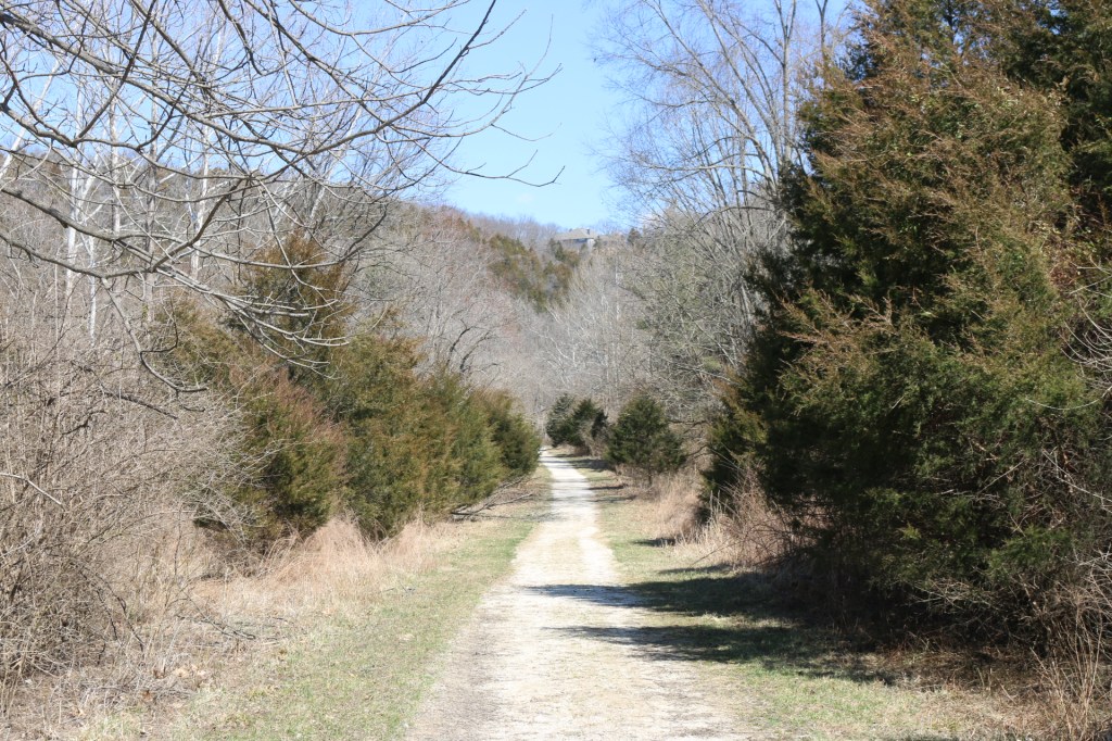
I have come to Route 66 State Park to look for ghosts of Times Beach. If I were not looking for it, I would have scarcely known the town had been here, or the story of contamination and abandonment on the landscape. The park today has faint traces of the town that was here forty years ago. Times Beach was laid out in long blocks that followed the bend in the river. It created a quarter circle that went from 12:00 to 3:00. The historic streets express themselves in the roads and paths of the park, but you have to know to look for it. Having straight lines to get around is more common in a town grid than a wooded park on the riverbank. But this is more discernible from the air than on foot. On the ground I find myself thinking more of the trees on either side of me.
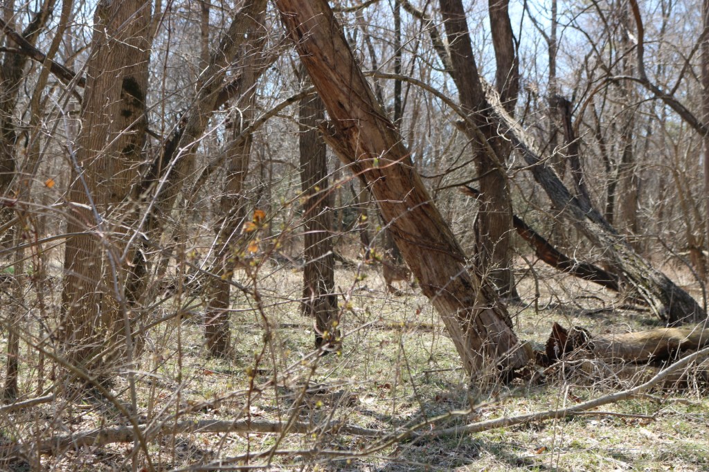
Along the several blocks closest to the riverbank, a successional woodland has grown up over the last twenty years. The remediation must not have laid the entire town to bare earth, because there are mature trees clustered in a way that once gave a parklike setting to Times Beach. It is too early for that spring haze of chartreuse to be showing on the branches. The woods are gray and brown, with the slightest burgeoning of red on the first maples. A spring herd of whitetail deer browse underneath with indifference to me. Eight does and juveniles take turns staring at me with mild curiosity, the way park deer do when there are no wolves, and dogs are leashed. The first of spring is too early for fawns and too late for bucks to be in the group. They only move on when they have made a collective decision against the clicking of my camera. Grey squirrels root through the dry leaves looking for last season’s nuts getting ready to sprout or this season’s first crop of morels. I hear them more than see them making industrious forays into that sweet zone under the leaf litter.
The blocks closest to the river contained houses in the Times Beach era. Today there are no visible signs of foundations. No stone front steps. No hint of infrastructure that might still be underground or utility poles overhead. At one point on the path I spy a long, straight, low earthen berm cut away from me that makes me wonder if it is an old boundary marker. It looks like a windrow or a tumbled stone wall, but neither of these would have been here. It simply looks like a fire break in the woods, or an even more unintentional plow furrow from some earth moving or pipe excavating.
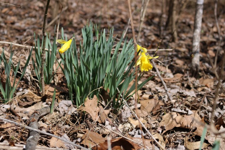
There is springtime evidence that people once lived here. Thick clumps of jonquils are blooming in the afternoon sun. They are untended in the woods, which had been someone’s front yard. Jonquils surviving abandonment is not news. They sprout every spring around foundation stones and long rotted fenceposts, where some industrious homeowner once put down roots. How they survived remediation is more curious, where roadside soils had been scraped and cooked in an incinerator. These bulbs grew along a park path that had been a gravel town road. Did they absorb the dioxin that was sprayed there for years? Are there traces of dioxin in these harbingers of spring? Have poison poppies gained an ally in dioxin daffodils? It makes me wonder what amount of soil remediation occurred to declare the former town to be clean enough for a park?
On the blocks farthest from from river, the park is patchier, alternating copses and turf fields delineated by hedgerows. Many of the trees are clearly older than three decades. There are ponds of different sizes. On the equinox in Missouri, spring peepers are active, although they don’t sound like the peepers I am familiar with. Their calling is between a peep and a croak. Throatier and deeper in tone, it is coming full on at two in the afternoon. This pool is in its vernal fullness — there are trees standing in the water and thick bushes lining the edge so that always elusive line between dry land and wet land is today unfindable. The peeper chorus comes from everywhere and nowhere. I know if I can train my eyes to see one amphibian I will suddenly be able to see thousands, like I have gained access to a secret world. But alas, it is a task too great for my capabilities. I try to creep closer to the water, but even my gentlest footfalls vibrate the ground enough to alarm the choir. Where a wetland rave was going down, my advance of a mere ten feet causes utter silence. I can only continue my walk and leave this population of spring peepers to carry on.
My rumination walking back to the car, superficial surveillance belies that this state park was once a small town, much less one of the most famous environmental cleanup sites in the United States. There is a legacy on this landscape, although it is perverse. Today we have a light use public park, nominally commemorating a decommissioned highway, which ran through here and left relics on the land. However, there were 292 miles of Route 66 in Missouri. Furthermore, Springfield, Missouri had a central role in the history of the highway. A memorial park elsewhere in the state would have made sense. But here the state owned land inadvertently in a place that no one else would want to own. Landscape legacies occur because the history and attributes of a place affect the prospects for both what can and can not be done. Repurposing the Town of Times Beach to Route 66 State Park, was an opportunistic decision to create an asset out of a poisoned place. There is a spirit of this place, but it won’t reveal itself with just casual observation.
