
Matanza Riachuelo translates to “little river of slaughter,” alluding to a sometimes bleak history. Yet standing on the riverbank on a bright summer day in March, the scene is serene. The riparian park is verdant; the cityscape, while not affluent, appears tidy. The langid black water eases towards the Rio de la Plata. It is an enticing landscape, if you avoid looking in the dark river with its swirling jewel tones of an oil sheen.
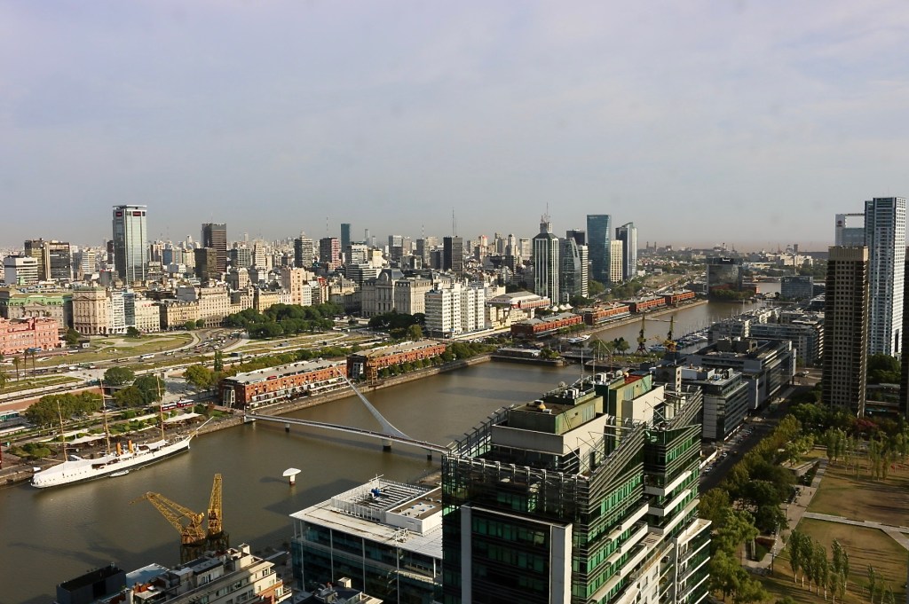
As rivers go, the Matanza Riachuelo is tiny, but even in its 64-kilometer run, the local name for it changes. Downstream, where it forms the border between the city and province, is known simply as Riachuelo — little river. Here the landscape is highly urbanized and intensively used. The mouth of the river, La Boca, was the original harbor for Buenos Aires.

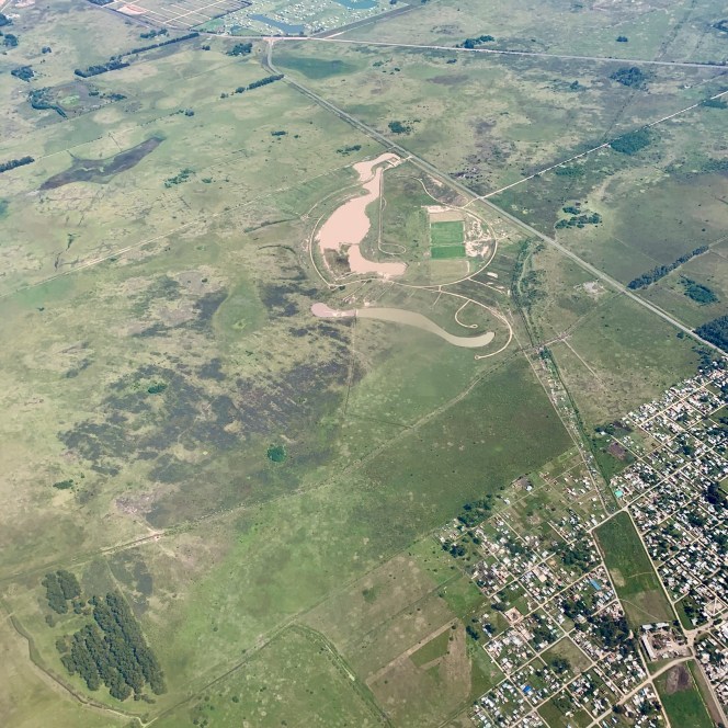
The headwaters of the Rio Matanza lie in the province to the southwest. They drain land once grazed by giant ground sloths, Megatherium, as large as elephants. Early human inhabitants on the Pampas helped drive the massive sloths to extinction.
The name, Matanza, was first used over 400 years ago, likely as an homage to the Spanish conquistadors defeated in 1536 by Querandi warriors. After the bloody event, it would be forty years before the Spaniards attempted a comeback here.
Reinforcing the name, slaughterhouses and tanneries grew up along the riverbanks, processing cattle that gauchos herded on Argentina’s famed Pampas. Modern humans in the watershed built a global city with an international airport and petrochemical plants. They divided the land into farming, industry, and housing.
Contemporary Buenos Aires is a metro of 15 million people with four centuries of history. As a colonial and then federal capital there are monumental plazas, centers of commerce, and grand neighborhoods.
There are also informal settlements throughout the region providing homes to hundreds of thousands of residents. They are called villas, pronounced ‘vee-zhas,’ in the local Porteño Spanish. Scores of them exist along railroad tracks, on unclaimed land, and on riverbanks. Although they sit on land tenuously held, the dwellings are solid permanent structures that are bought and sold. Some of these so-called informal settlements are quite formalized, with paved roads and city services. Others are not.
At times in history, authoritarian regimes cleared the villas and demolished the structures, but with an overwhelming housing need and a remarkably durable social structure they returned. The villas along the Riachuelo began in the 1930s and filled in the spaces between the platted neighborhoods and factories and the riverbanks. The slow accretion of the built environment in older villas created a dense, multistoried streetscape.
I visited the Riachuelo on a work day. There was little outdoor activity to be seen. Our hosts from INSITU, an interdisciplinary group of engineers and sociologists, guided us through the recent history of the river and its neighborhoods. We toured a two kilometer reach between the Puente Bosch and a large oxbow upstream. Here, the northern bank is in the Autonomous City of Buenos Aires while the southern bank is in Buenos Aires Province.
The provincial south side is industrial. Near the mouth are port facilities around Dock Sud, with container docks and petroleum tank farms. Squeezed in between the docks and the tank farms is the Villa Inflamable. In 2004, citizens from Villa Inflamable sued 44 companies and various governmental entities including the federal government about pollution that damaged their health. In 2006 the national government created ACUMAR, the Autoridad de Cuenca Matanza Riachuelo, the first intergovernmental river basin commission in Argentina. In 2008 the Supreme Court found the federal, provincial, and city governments were collectively responsible for cleaning the river, mitigating the health impacts on the nearby citizens, and restoring the ecology. The newly established ACUMAR took responsibility for the restoration.
The court decision also led to the establishment of a protected riparian zone 35 meters from the shoreline, the very riverbank where so many villas had been built. This did not impact Villa Inflamable but it did cause the relocation of 17,000 people in other villas and the demolition of their houses.
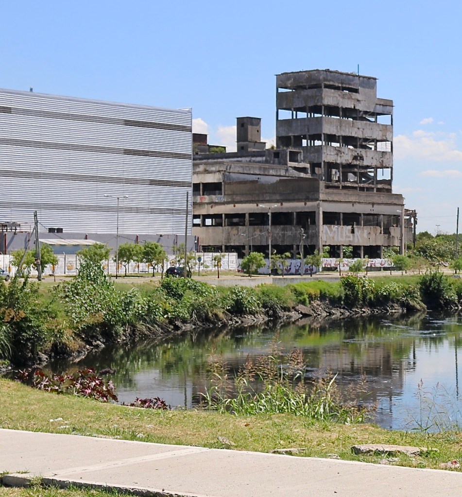
Upstream on the south bank we find inscrutable, large buildings, which could be warehouses or power plants. The older structures are abandoned in varying states of decay. The newer ones are nameless behemoths. It’s a scene I’ve seen repeated in industrial port cities in the United States. Two kilometers upstream from the bridge, a road leads onto a large oxbow in the river holding playing fields and a park. From the bank we look across into the city, to the expansive Villas 21-24, where thousands of people live. Ad hoc houses of concrete and red chunky bricks rise to three stories. Partially completed rooms are piled onto lower floors. Riparian clearing here is fresh and raw. All structures within 35 meters of the river have been scraped clear, leaving bare dirt.
Heading back down to the bridge, we cross over to the city. The riverine landscape on the cityside has changed considerably in the last few years, although the dominant land uses remain. The area is densely urbanized, with logistics, industry, and urban neighborhoods crowded together. Across dozens of blocks closest to the river are large warehouses, offices, and service sheds of varying ages. Many of these are dedicated to the logistics and transit industries, which keep the port city moving. Uphill from the warehouses lies the established neighborhood of Barracas — the barracks, a traditionally working class neighborhood long connected to the harbor.
Our friends from INSITU produce historic aerial photographs going back 90 years. What were empty lands unsuitably close to a polluted industrial river gradually filled in with paved roads, warehouses, and informal housing. Two long blocks up from the bridge is the inlet of a cloaca draining Barracas. Between the two landmarks Villa 26 grew, a long narrow neighborhood clinging to the river with a maze of alleys. In the final image there is a large flood control structure covering the entrance of the sewer and the first block of Villa 26 is replaced with a new park with bright white paths.
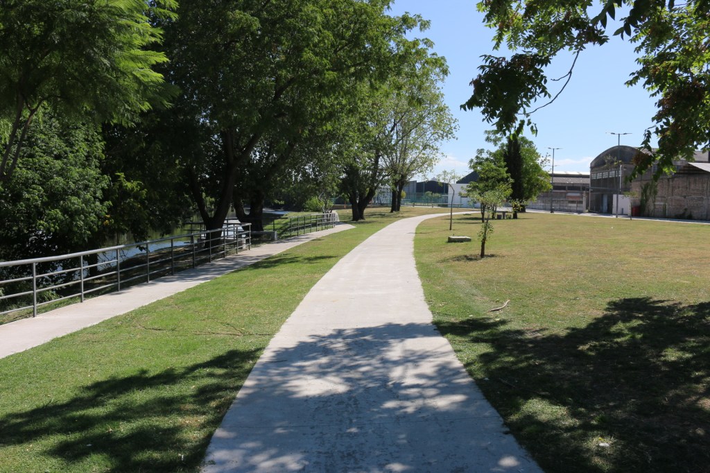
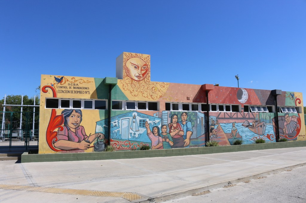
We walk this path — between a massive bus maintenance shed and the Riachuelo — along mown grass and built in tables. It is by all accounts a modern riverfront amenity, although evidence of disharmony lies in the smashed glass checkerboard tiles embedded in the concrete game tables.
This park sits where houses recently stood. The remains of one recently demolished obstruct the path ahead. An orange plastic water pipe sticks out of the rubble bleeding water onto the remains. The layout of domesticity is exposed for the world to see.
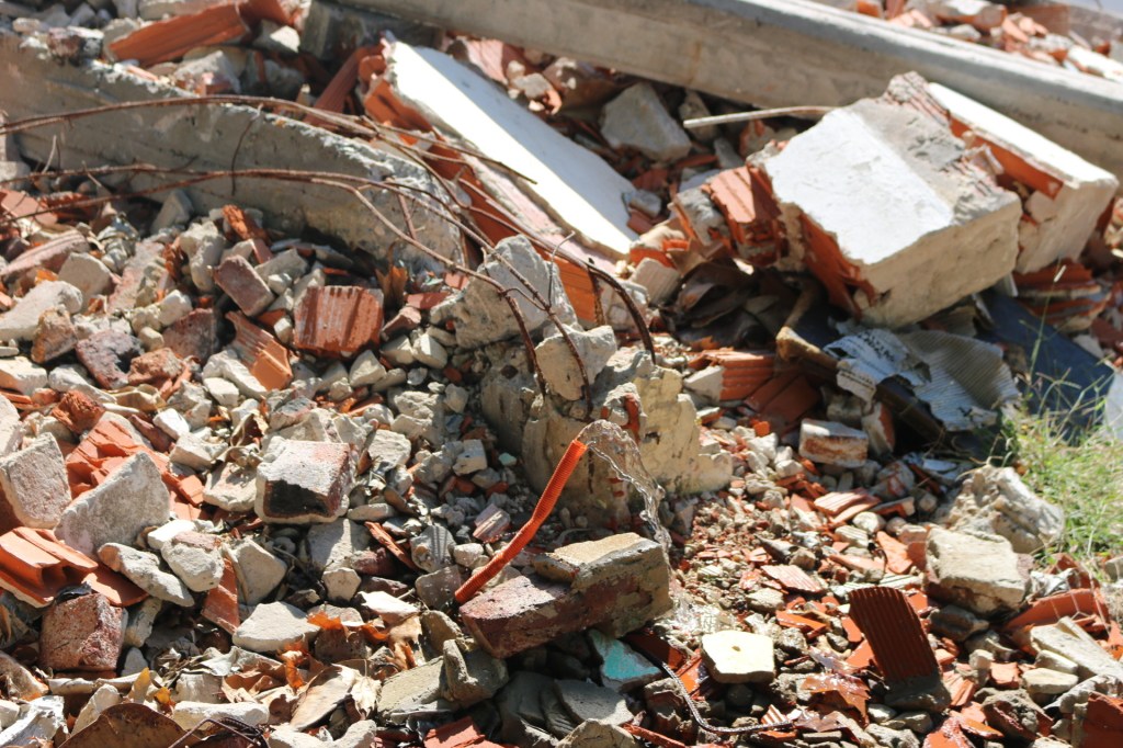
This brand new park sits on the site of Villa 26. The houses here were razed for being too close to the water and threatening environmental health. The residents were given new apartments many blocks away as compensation, but already reports of faulty construction surface. There is irony that a legal action initially started for environmental justice of citizens near a polluted river would result in the relocation of many of them.
In the next block the warehouses sit farther from the bank. A handful of houses beyond the reach of 35 meters cling to the wall of the warehouse, wash out to dry, children checking out our strange party.
The outfall of the buried urban stream is now a modern concrete structure. I will need to consult an engineer to explain how the stormwater and sewage from the city are being managed. Large hatches suggest this infrastructure is to prevent the Riachuelo from backing up into the neighborhood when strong easterlies cause wind-driven floods or to block sewage from directly entering the river here. Or both.
With this much contamination and this much density, conflict was bound to ensue. As is the case with so many small urban rivers, the Riachuelo is polluted. Decades of industrial use have degraded the river and the environmental quality of the landscape. Unfiltered urbanization added to the damage.
The Matanza Riachuelo has parallels with rivers in the United States: the Buffalo Bayou in Houston, the Anacostia in Washington, the Patapsco in Baltimore, and the Cuyahoga in Cleveland come to mind. These riverine landscapes each have distinct stories but with common themes.
The Matanza Riachuelo is a small river with a deep, complex narrative. A visit to one reach of it, studying historic photographs and talking to professionals helping to improve living conditions, gives an intriguing snapshot of a dynamic place. But it is just a snapshot. The complexity of the river, its people, and its history evinces this landscape has more stories to tell.
