Landscapes have narrative. There is history on the land. It might not be written in stone, but it can be read in the buildings, roads, and towns; in the trees, rocks, and animals; and even in the stories and ruins that linger. A landscape’s history can be chronicled in distinct periods, with each period having its own patterns of vegetation, land use, and culture.
Dogtown is a ghost town in the heart of Cape Ann, Massachusetts, with a landscape history that has three distinct periods in the historic era. The narrative before that is less specific, but into the 17th century the area we know as Cape Ann was the land of the Wampanoag people. Of course there were other cultures on the land even before them. These indigenous cultures lived on the land but were not a disruptive force reshaping it.
What did shape the land was the grating movement of continental glaciers during the Quaternary ice ages. The most recent, the Wisconsin glaciation, covered all of New England at its glacial maximum around 22,000 years ago. The glaciers scraped the land clear, weighed down the tectonic plate, depressing it. As the glaciers melted they deposited moraine in the form of erratic boulders. Modern climate conditions settled in about 11,000 years ago, until we started messing with it of course. The consequence of the glaciers followed by a warming climate was a landscape which has granite bedrock emerging from the Atlantic Ocean in a still-ongoing process called isostatic uplift. This phenomenon gives Cape Ann its rocky tidal coastline except in protected coves where sand accumulates or in marshy alluvial deltas. The erratics occur around the cape with bands of deeper terminal moraine marking where glacial advance stalled for a period. Topography, climate, and a mere few thousands years has yielded but scant soil formation.
I wanted to visit Dogtown for decades. When I first started coming to Cape Ann in the 1980s, it was marked as a ghost town on the map. How could I not be intrigued? I asked a local friend about getting there to explore and was told, “You don’t want to go up there,” with the explanation that there were questionable folks in the woods. I didn’t know it at the time but a local schoolteacher out for a walk had recently been bludgeoned to death by a local man with psychiatric issues.
But over the years Dogtown captured the public’s imagination through popular culture. More resources about trail hikes became available. Its reputation improved. For 30 years it was like that museum in town you want to see but never get to because you could go at any time. There was always a better time to pick when the kids were older, or it wasn’t raining, or there weren’t the heat and mosquitoes of summer. But an October vacation with visiting friends was the perfect chance to go exploring.
The Commons Settlement, as it was originally called, dates to the beginning of Gloucester in the 1640s, when English colonists arrived with the grazing animals and metal-tipped tools like axes and plows. For 150 years, a village of nearly 100 houses spread over the high middle of the cape. The vantage offered better defensive position from marauding pirates who would take advantage of the many natural coves and harbors. The forests were cleared and grazing animals kept the commons in pasturage. Where soil permitted, small scale farming occurred, although it was not suitable for raising market crops. Fishing in Gloucester at the time was also small scale, plying only the local waters. It was a hardscrabble but sustainable livelihood, although contemporary towns Salem and Boston were growing. The defensive advantages were again valued during the American Revolution.
Landscapes are defined in part by the cultural values that are overlain on physical and biological attributes. After the American War of Independence, economic and security concerns changed. Gloucester Harbor became the locus of activity and the city grew around it. The Commons Settlement waned. For several decades longer war widows lived in the remaining houses and, according to local lore, kept dogs for protection. By 1830 no one lived in the village. Eventually the houses disappeared, with the last one torn down in 1845. All that remained from the village were stone cellars and dirt roads. And the dogs that gave the place its new name.
The next hundred years were the period of Dogtown Common. The landscape at this time was abandoned, as all the settlement and roads around Cape Ann developed on the coast. The upland was used for logging and for pasturage, and in some areas for granite quarrying. When the Town of Rockport was incorporated out of Gloucester in 1840, Dogtown Common was split between the two towns. Henry David Thoreau described the peculiar scenery in his journal in September 1858: “We found ourselves in the midst of boulders scattered over bare hills and fields.” Historical photographs through the century show a place devoid of trees.

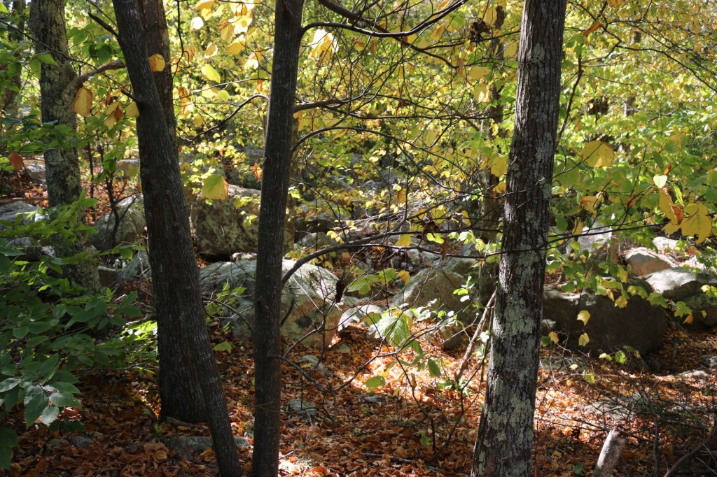
The conservation period of Dogtown Woods got its start in the 1930s. Roger Babson was a tenth-generation descendent of Isabel Babson, who sailed from England at the age of 60 with two sons and was the founding mother of the Babson family in Gloucester in the early 1600s. Roger, born there in 1875, made his fortune in investment banking and business information. Along with a cousin, Gustavas, he bought 1150 acres of land in Dogtown in 1927. Several years later they transferred it to the City of Gloucester for conservation and watershed protection. This was around this time the Babson Reservoir and Goose Cove Reservoir were built for municipal water supply. It is often the case that cities protect headwaters through land conservation. The city later added an additional 800 acres to the preserve. In the 90 years since, Dogtown has gone from an open pasture and boulder field with long vistas to a regrowth of New England forest. The woods themselves are dense and scraggy but not tall. Thin hilltop soils are droughty and slow the regrowth of the forest. Still they serve as good cover for the headwaters of the reservoirs.
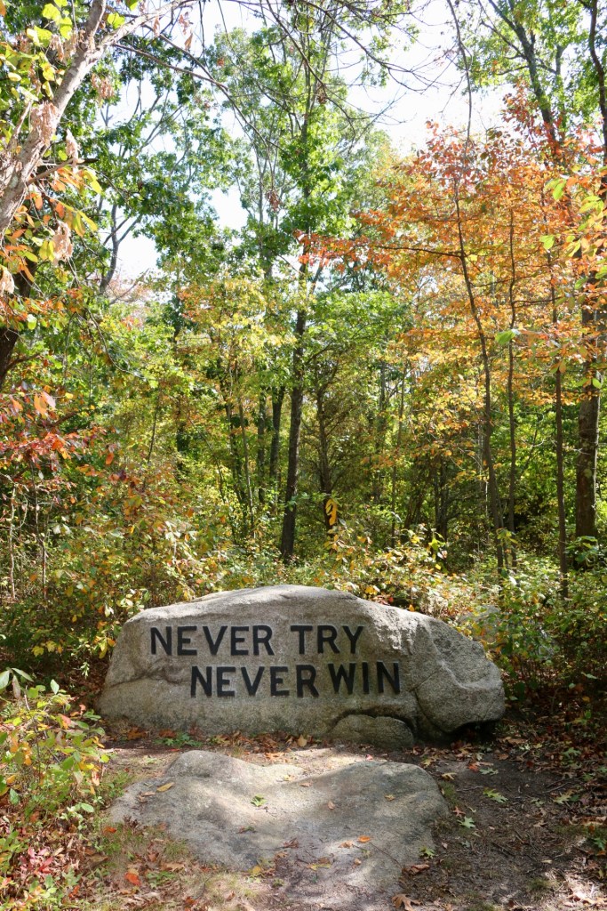
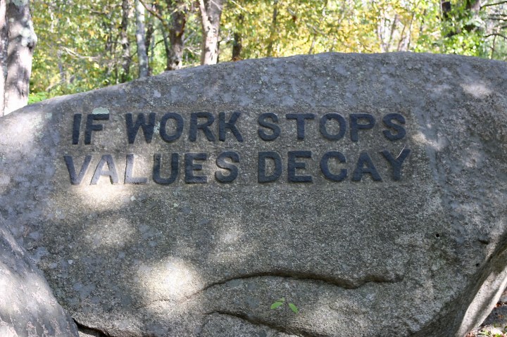
Before Babson turned over the land he left his own idiosyncratic mark. Using old maps and field surveys, he identified the extant cellars of the Commons Settlement and labelled them by having stone carvers place granite markers. Granite was a dominant industry on Cape Ann at the time, but the depression left stonecutters out of work. With the intention of providing employment, Babson employed quarrymen to carve inspirational sayings into giant boulders across Dogtown. This was not without raising some local eyebrows, though. He even reported in his autobiography, “My family says that I am defacing the boulders and disgracing the family with these inscriptions, but the work gives me a lot of satisfaction, fresh air, exercise and sunshine.”
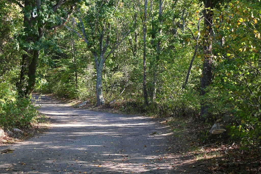
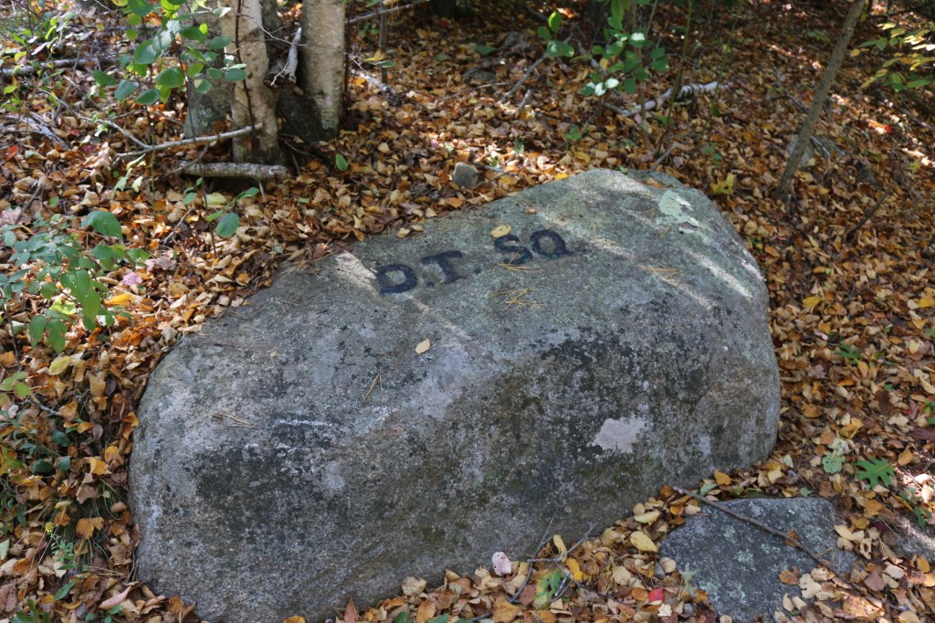
October is a fine time to walk in Dogtown Woods. Like spokes on a wheel, there are many paths on the cape that get to the center. We park our car as far up Dogtown Road as we could before the gate. From here we could head south down to Babson Reservoir or head uphill towards the ghost village. We head up. The city owns the land, which is all woods except for the reservoirs and a large clearing that serves as the city’s compost yard. The path up starts wide but becomes closed in as we climb. Halfway way up we see the first stone marking an old house. If not for the marker, we would walk past unaware. Three-hundred year old stone cellars look like piles of granite rocks with trees growing out of them. Continuing on the main road we come to a place where paths converge, set with a marker saying D.T. SQ for Dogtown Square, a name that people who lived here never used.
From here we begin our scavenger hunt in earnest. Aided by a map, we look for Babson’s boulders. It’s an odd but entertaining activity in the woods. Coming up we were by ourselves, but in Dogtown we are joined by many other parties joining from the other spokes. Soon there are dozens of other people generally hiking and specifically looking for words of inspiration. It’s a bit of a challenge since many of the maxims are off the paths, often with the words turned towards the woods. There are 24 in total. The throng of people running about on a boulder scavenger hunt gives an air of a party.
The current landscape phase of Dogtown persists as a wooded reservation used for water-catchment and by citizens for outdoor recreation. But the big, historical arc of this ghost town at the center of Cape Ann, Massachusetts, teaches us how a landscape changes from glacial and periglacial biomes, to low-impact indigenous territory, into colonial settlements, through open pasture, to a forested preserve, with many smaller narratives about the landscape and about the people on the land. Being able to see landscape as narrative — as a changing story — enables us to understand it better. It also empowers us to imagine how landscapes might thrive in the future.

